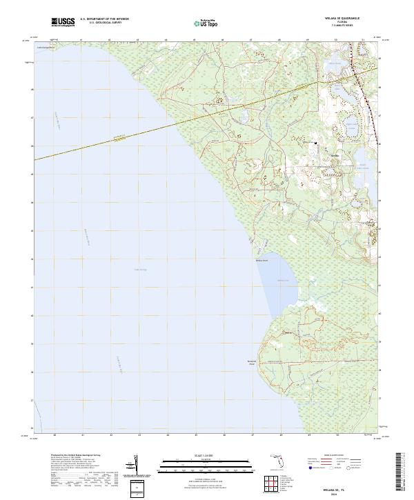
2024 Map of Welaka SE
USGS Topo · Published 2024About this map
The eastern shore of Lake George and the winding Saint Johns River dominate this Florida landscape, where the waters of Willow Cove meet the dense interior wetlands. Near the settlement of Seville, the terrain is marked by a network of local roads and trails such as Union Bag Trl and Nine Mile Point Trl, reflecting the area's long-standing connection to timber and land management. The Lake George Conservation Area Trl provides a modern recreational layer over a landscape historically defined by its hydrologic features, including Upper Lake Louise, Lower Lake Louise, and several named ponds.
Find a feature on this map
55 named features on this map. Tap any name to fly to it.
Don’t see what you’re looking for? This feature index may not catch every label — zoom into the map to look around manually.
Map Details
Editions of this 2024 Welaka SE Map
This is the sole edition of this map. No revisions or reprints were ever made.
Other maps of this area

1954 · Daytona Beach
USGS Topo · 1:250,000

1958 · Daytona Beach
USGS Topo · 1:250,000

1964 · Daytona Beach
USGS Topo · 1:250,000

1970 · Crescent City
USGS Topo · 1:24,000

1970 · Welaka SE
USGS Topo · 1:24,000

1970 · Welaka
USGS Topo · 1:24,000

1970 · Seville
USGS Topo · 1:24,000

1970 · Salt Springs
USGS Topo · 1:24,000

1970 · Pierson
USGS Topo · 1:24,000

1972 · Juniper Springs
USGS Topo · 1:24,000