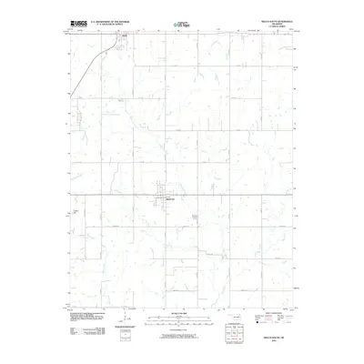
2010 Map of Welch South
USGS Topo · Published 2010About this map
Bluejacket and the southern edge of Welch anchor this rural landscape in northeastern Oklahoma, defined by a dense network of sectional roads and meandering prairie waterways. The terrain is marked by the prominence of Timber Hill in the southwest, while the local drainage system including Little Cabin Creek, Cow Creek, and Wolf Creek dictates the movement of the land. This survey reveals a meticulously partitioned agricultural region, where the grid of rural routes such as S 4430 RD and E 110 RD provides access to scattered homesteads and local landmarks. For those tracing family history in Craig County, the location of the Bluejacket Cemetery and the relationship between the small town centers and their surrounding creek branches like Whiskey Branch and Possum Branch offer essential geographic context.
Find a feature on this map
26 named features on this map. Tap any name to fly to it.
Don’t see what you’re looking for? This feature index may not catch every label — zoom into the map to look around manually.
Map Details
Editions of this 2010 Welch South Map
This is the sole edition of this map. No revisions or reprints were ever made.
Other maps of this area

1901 · Vinita
USGS Topo · 1:125,000

1907 · Wyandotte
USGS Topo · 1:125,000

1909 · Wyandotte
USGS Topo · 1:125,000

1913 · Vinita
USGS Topo · 1:125,000

1954 · Tulsa
USGS Topo · 1:250,000

1958 · Tulsa
USGS Topo · 1:250,000
1961 · Miami NW
USGS Topo · 1:24,000

1961 · Miami SW
USGS Topo · 1:24,000

1963 · Tulsa
USGS Topo · 1:250,000
1971 · Pyramid Corners
USGS Topo · 1:24,000