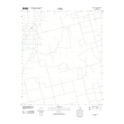
2010 Map of Welch SW
USGS Topo · Published 2010About this map
The Cedar Lake Oil Field dominates the northwest corner of this West Texas landscape, illustrating the industrial footprint on the High Plains during the early 21st century. This region of Gaines County is characterized by a sparse, geometric road network designed for heavy machinery and oil production access. Long, straight corridors like Ranch Rd 1066 and Co Rd 8 slice across the arid terrain, connecting remote pump jacks and well sites to the larger regional infrastructure. The map reveals the intricate secondary system of county routes, including Co Rd 147 and Co Rd 151, which define the property boundaries and operational zones of the petroleum industry in this part of the Llano Estacado. This survey provides a clear look at the spatial organization of energy extraction in a landscape otherwise defined by its vastness and isolation.
Find a feature on this map
12 named features on this map. Tap any name to fly to it.
Don’t see what you’re looking for? This feature index may not catch every label — zoom into the map to look around manually.
Map Details
Editions of this 2010 Welch SW Map
This is the sole edition of this map. No revisions or reprints were ever made.
Other maps of this area

1954 · Hobbs
USGS Topo · 1:250,000

1958 · Hobbs
USGS Topo · 1:250,000

1969 · Welch East
USGS Topo · 1:24,000

1969 · Ashmore
USGS Topo · 1:24,000

1969 · Welch SW
USGS Topo · 1:24,000

1969 · Punkin Center
USGS Topo · 1:24,000
1969 · Welch West
USGS Topo · 1:24,000

1970 · Sand
USGS Topo · 1:24,000

1970 · McKenzie Lake
USGS Topo · 1:24,000
1970 · Cedar Point
USGS Topo · 1:24,000