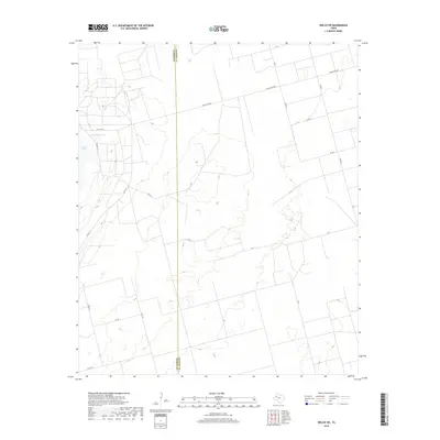
2019 Map of Welch SW
USGS Topo · Published 2019About this map
The boundary between Gaines Co and Dawson Co runs north-south through this high plains landscape, where the flat terrain is primarily defined by a sparse but systematic network of rural roads. The western edge of the map features a portion of Cedar Lake, a distinctive natural basin that contrasts with the surrounding agricultural and ranch land. This area is etched by numerous local routes like Co Rd 147, Co Rd 151, and Cr 11, which provide access to the expansive properties characteristic of the Texas South Plains. While modern in its survey date, the map preserves the traditional land divisions and ranching corridors, including Ranch Rd 1066 and Fm Rd 1066, which serve as the primary east-west arteries connecting these remote counties.
Find a feature on this map
19 named features on this map. Tap any name to fly to it.
Don’t see what you’re looking for? This feature index may not catch every label — zoom into the map to look around manually.
Map Details
Editions of this 2019 Welch SW Map
This is the sole edition of this map. No revisions or reprints were ever made.
Other maps of this area

1954 · Hobbs
USGS Topo · 1:250,000

1958 · Hobbs
USGS Topo · 1:250,000

1969 · Welch East
USGS Topo · 1:24,000

1969 · Ashmore
USGS Topo · 1:24,000

1969 · Welch SW
USGS Topo · 1:24,000

1969 · Punkin Center
USGS Topo · 1:24,000
1969 · Welch West
USGS Topo · 1:24,000

1970 · Sand
USGS Topo · 1:24,000

1970 · McKenzie Lake
USGS Topo · 1:24,000
1970 · Cedar Point
USGS Topo · 1:24,000