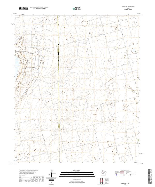
2022 Map of Welch SW
USGS Topo · Published 2022About this map
The West Texas plains are defined by their orderly grid and unique topography, as shown along the Gaines Co and Dawson Co line. A significant portion of this landscape is occupied by Cedar Lake, an expansive depression that stands out against the surrounding ranchlands and agricultural tracts. This terrain is characteristic of the Llano Estacado, where subtle elevation changes and interior drainage basins like these playas dictate the local geography.
Find a feature on this map
20 named features on this map. Tap any name to fly to it.
Don’t see what you’re looking for? This feature index may not catch every label — zoom into the map to look around manually.
Map Details
Editions of this 2022 Welch SW Map
This is the sole edition of this map. No revisions or reprints were ever made.
Other maps of this area

1954 · Hobbs
USGS Topo · 1:250,000

1958 · Hobbs
USGS Topo · 1:250,000

1969 · Welch East
USGS Topo · 1:24,000

1969 · Ashmore
USGS Topo · 1:24,000

1969 · Welch SW
USGS Topo · 1:24,000

1969 · Punkin Center
USGS Topo · 1:24,000
1969 · Welch West
USGS Topo · 1:24,000

1970 · Sand
USGS Topo · 1:24,000

1970 · McKenzie Lake
USGS Topo · 1:24,000
1970 · Cedar Point
USGS Topo · 1:24,000