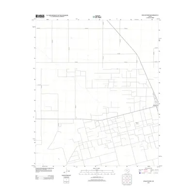
2012 Map of Welch West
USGS Topo · Published 2012About this map
Welch sits as the primary settlement on this West Texas landscape, positioned where Ranch Road 829 meets a series of local thoroughfares including Main St, Elm, and Fir. The geography is defined by a rigorous grid of county roads, such as Co Rd-670 and Co Rd-521, which partition the territory into large agricultural or industrial blocks. This rigid infrastructure supports the localized extraction economy, most notably evidenced by the extensive Welch Oil Field that occupies the southern portion of the quadrangle.
Find a feature on this map
21 named features on this map. Tap any name to fly to it.
Don’t see what you’re looking for? This feature index may not catch every label — zoom into the map to look around manually.
Map Details
Editions of this 2012 Welch West Map
This is the sole edition of this map. No revisions or reprints were ever made.
Other maps of this area

1954 · Hobbs
USGS Topo · 1:250,000

1954 · Brownfield
USGS Topo · 1:250,000

1958 · Brownfield
USGS Topo · 1:250,000

1958 · Hobbs
USGS Topo · 1:250,000

1962 · Brownfield
USGS Topo · 1:250,000

1969 · Foster
USGS Topo · 1:24,000

1969 · Welch East
USGS Topo · 1:24,000

1969 · Ashmore
USGS Topo · 1:24,000

1969 · New Moore
USGS Topo · 1:24,000

1969 · Welch SW
USGS Topo · 1:24,000