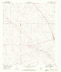
1969 Map of Welch West
USGS Topo · Published 1971About this map
Welch Oil Field dominates this West Texas landscape, illustrating the intensive petroleum extraction character of the Permian Basin during the late 1960s. The settlement of Welch sits on the eastern edge of the survey, marked by a Wt (water tower) and a grid of local roads. The terrain is defined by the broad, meandering path of Sulphur Springs Draw, which cuts diagonally across the quadrangle. Outside of the primary oil field, the land is dotted with numerous individual Oil Wells and several Gravel Pits, indicating a landscape shaped almost entirely by resource extraction. The map also records several political boundaries where Terry, Gaines, and Dawson counties meet, showing how these administrative lines intersect with the industrial infrastructure of the day.
Find a feature on this map
10 named features on this map. Tap any name to fly to it.
Don’t see what you’re looking for? This feature index may not catch every label — zoom into the map to look around manually.
Map Details
Editions of this 1969 Welch West Map
This is the sole edition of this map. No revisions or reprints were ever made.
Other maps of this area

1954 · Hobbs
USGS Topo · 1:250,000

1954 · Brownfield
USGS Topo · 1:250,000

1958 · Brownfield
USGS Topo · 1:250,000

1958 · Hobbs
USGS Topo · 1:250,000

1962 · Brownfield
USGS Topo · 1:250,000

1969 · Foster
USGS Topo · 1:24,000

1969 · Welch East
USGS Topo · 1:24,000

1969 · Ashmore
USGS Topo · 1:24,000

1969 · New Moore
USGS Topo · 1:24,000

1969 · Welch SW
USGS Topo · 1:24,000