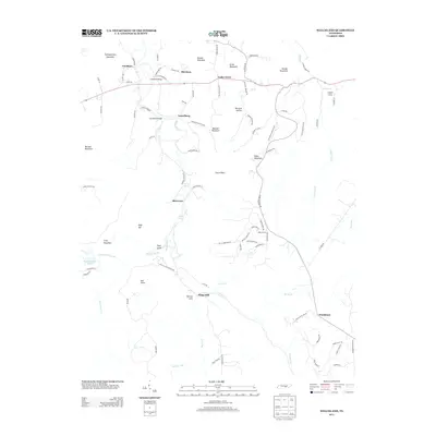
2013 Map of Welchland
USGS Topo · Published 2013About this map
Rocky River winds through this rugged portion of the Cumberland Plateau, serving as the central drainage for a landscape defined by prominent ridges and deep hollows. The rural character of the area is anchored by scattered settlements like Goodbars, Harmony, and Laurelburg, connected by historical river crossings including Goodbar Bridge and Laurelburg Bridge. These points of transit illustrate how the terrain dictated movement between the high points of Moulder Mountain and Turkeyscratch Mountain. For genealogists and local historians, the placement of the Hillis Cemetery and Arch Hillis Cemetery near the riverbanks provides tangible links to the families who settled this region. Significant water features such as Boyd Spring and the Boyd Brothers Lake underscore the importance of local hydrology in a territory dominated by timbered slopes and creek-fed valleys like Mitchell Hollow.
Find a feature on this map
94 named features on this map. Tap any name to fly to it.
Don’t see what you’re looking for? This feature index may not catch every label — zoom into the map to look around manually.
Map Details
Editions of this 2013 Welchland Map
This is the sole edition of this map. No revisions or reprints were ever made.
Other maps of this area

1892 · Pikeville
USGS Topo · 1:125,000

1893 · Mc Minnville
USGS Topo · 1:125,000

1895 · Mc Minnville
USGS Topo · 1:125,000

1895 · Pikeville
USGS Topo · 1:125,000

1935 · Smart Mountain
USGS Topo · 1:24,000

1943 · Cookeville
USGS Topo · 1:100,000

1944 · Cookeville
USGS Topo · 1:100,000
1946 · Smartt Mountain
USGS Topo · 1:24,000
1947 · Smartt Mountain
USGS Topo · 1:24,000

1953 · Chattanooga
USGS Topo · 1:250,000