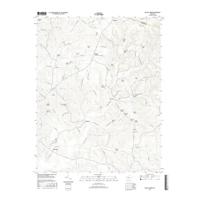
2016 Map of Welchs Creek
USGS Topo · Published 2016About this map
The ridge and hollow country of Grayson and Butler counties is defined by a dense network of family-named landmarks and rural settlements. Communities like Brooklyn, Welchs Creek, and Huldeville are central points in a landscape carved by Welch Creek, Harrison Fork Welch Creek, and Woosley Creek. The geography is remarkably personal, with features such as Jim Buck Hollow, Rueben Hollow, and Johnson Hollow indicating long-standing local ties. Higher elevations include Turkey Knob Ridge and the prominent Buzzards Roost Bluff. Genealogists will find significant value in the distribution of small burial grounds across these hills, including Henderson Cemetery, Needmore Cemetery, and Buffalo Cemetery, many of which sit near former school sites like Old Brooklyn School Road. The transition from river bottoms to high points like Frog Level Ridge illustrates the traditional Kentucky pattern of ridge-top travel and creek-bottom farming.
Find a feature on this map
109 named features on this map. Tap any name to fly to it.
Don’t see what you’re looking for? This feature index may not catch every label — zoom into the map to look around manually.
Map Details
Editions of this 2016 Welchs Creek Map
This is the sole edition of this map. No revisions or reprints were ever made.
Other maps of this area

1914 · Little Muddy
USGS Topo · 1:62,500

1922 · Leitchfield
USGS Topo · 1:48,000

1922 · Brownsville
USGS Topo · 1:62,500

1923 · Brownsville
USGS Topo · 1:62,500

1925 · Spring Lick
USGS Topo · 1:62,500

1925 · Leitchfield
USGS Topo · 1:62,500

1953 · Ready
USGS Topo · 1:24,000

1954 · Evansville
USGS Topo · 1:250,000

1954 · Spring Lick
USGS Topo · 1:24,000

1954 · Welchs Creek
USGS Topo · 1:24,000