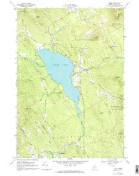
1968 Map of Weld
USGS Topo · Published 1970About this map
Webb Lake dominates the center of this 1960s survey, surrounded by the peaks and valleys of Weld, Carthage, and Perkins Plantation. The map details a landscape where small settlements like Weld Corner and Berry Mills are connected by winding valley roads that follow the drainage of Webb River and numerous mountain brooks. Extensive portions of the land are dedicated to Mount Blue State Park, which preserves the higher elevations around Center Hill and Hedgehog Hill.
Find a feature on this map
50 named features on this map. Tap any name to fly to it.
Don’t see what you’re looking for? This feature index may not catch every label — zoom into the map to look around manually.
Map Details
Editions of this 1968 Weld Map
3 editions found
Other maps of this area

1926 · Dixfield
USGS Topo · 1:62,500

1927 · Rumford
USGS Topo · 1:48,000

1929 · Phillips
USGS Topo · 1:48,000

1929 · Dixfield
USGS Topo · 1:62,500

1930 · Rumford
USGS Topo · 1:62,500

1932 · Phillips
USGS Topo · 1:62,500

1933 · Rangeley
USGS Topo · 1:48,000

1939 · Rangeley
USGS Topo · 1:62,500

1949 · Rangeley
USGS Topo · 1:62,500

1950 · Lewiston
USGS Topo · 1:250,000