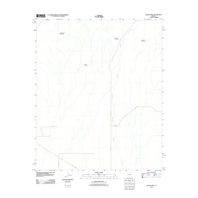
2011 Map of Weldon Hill
USGS Topo · Published 2011About this map
Weldon Hill serves as a central landmark in this arid stretch of Maricopa County, positioned between the Harquahala Mountains to the northwest and the Big Horn Mountains to the northeast. The landscape is defined by the complex drainage system of Tiger Wash, which runs vertically across the terrain, joined by smaller features like Blue Tank Canyon. Infrastructure in this sparsely populated area is limited to desert routes such as Eagle Eye Rd and the Buckeye-Salome Rd in the southern portion of the quadrangle. The presence of Desert Tank highlights the vital importance of water management in this desert environment. This survey captures a moment in the early 21st century when the region remained largely undeveloped, characterized by wide alluvial washes and significant mountain ranges.
Find a feature on this map
10 named features on this map. Tap any name to fly to it.
Don’t see what you’re looking for? This feature index may not catch every label — zoom into the map to look around manually.
Map Details
Editions of this 2011 Weldon Hill Map
This is the sole edition of this map. No revisions or reprints were ever made.
Other maps of this area

1942 · Vicksburg
USGS Topo · 1:250,000

1954 · Phoenix
USGS Topo · 1:250,000

1957 · Phoenix
USGS Topo · 1:250,000

1958 · Phoenix
USGS Topo · 1:250,000

1960 · Phoenix
USGS Topo · 1:250,000

1961 · Lone Mountain
USGS Topo · 1:62,500

1961 · Big Horn Mts
USGS Topo · 1:62,500

1961 · Gladden
USGS Topo · 1:62,500
1962 · Aguila
USGS Topo · 1:62,500

1969 · Phoenix
USGS Topo · 1:250,000