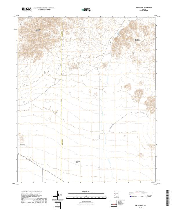
2021 Map of Weldon Hill
USGS Topo · Published 2021About this map
The rugged desert expanse of Maricopa and La Paz counties unfolds across this high-desert landscape, anchored by the prominent rise of Weldon Hill. The terrain transition is sharp, with the Harquahala Mountains dominating the northwest corner and the Big Horn Mountains rising to the northeast. These ranges drain into the expansive Harquahala Plain to the south, a region defined by complex drainage networks like Tiger Wash and the steep cuts of Blue Tank Canyon.
Find a feature on this map
17 named features on this map. Tap any name to fly to it.
Don’t see what you’re looking for? This feature index may not catch every label — zoom into the map to look around manually.
Map Details
Editions of this 2021 Weldon Hill Map
This is the sole edition of this map. No revisions or reprints were ever made.
Other maps of this area

1942 · Vicksburg
USGS Topo · 1:250,000

1954 · Phoenix
USGS Topo · 1:250,000

1957 · Phoenix
USGS Topo · 1:250,000

1958 · Phoenix
USGS Topo · 1:250,000

1960 · Phoenix
USGS Topo · 1:250,000

1961 · Lone Mountain
USGS Topo · 1:62,500

1961 · Big Horn Mts
USGS Topo · 1:62,500

1961 · Gladden
USGS Topo · 1:62,500
1962 · Aguila
USGS Topo · 1:62,500

1969 · Phoenix
USGS Topo · 1:250,000