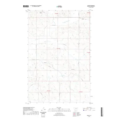
2020 Map of Weldon
USGS Topo · Published 2020About this map
The small settlement of Weldon serves as the focal point for this McCone County landscape, situated where Weldon Rd meets Prairie Elk Rd. The terrain is defined by a series of drainage networks, including McGuire Cr and its various forks, alongside Porcupine Coulee to the north and Coal Cr to the south. Two evocatively named high points, Big Heaven and Little Heaven, stand out as landmarks amidst the dissected prairie, while Dreyer Reservoir provides a critical water source in this semi-arid region.
Find a feature on this map
27 named features on this map. Tap any name to fly to it.
Don’t see what you’re looking for? This feature index may not catch every label — zoom into the map to look around manually.
Map Details
Editions of this 2020 Weldon Map
This is the sole edition of this map. No revisions or reprints were ever made.
Other maps of this area

1954 · Jordan
USGS Topo · 1:250,000

1954 · Glendive
USGS Topo · 1:250,000

1956 · Jordan
USGS Topo · 1:250,000

1957 · Glendive
USGS Topo · 1:250,000

1958 · Jordan
USGS Topo · 1:250,000

1958 · Glendive
USGS Topo · 1:250,000

1964 · Jordan
USGS Topo · 1:250,000

1973 · Crow Springs
USGS Topo · 1:24,000

1973 · Rodgers Hall
USGS Topo · 1:24,000

1978 · Fort Peck Lake East
USGS Topo · 1:100,000