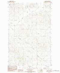
1983 Map of Weldon
USGS Topo · Published 1983About this map
Weldon stands at the northern edge of this McCone County landscape, a region defined by the intricate branching of the Middle Fork Mc Guire Creek and its many seasonal tributaries. The terrain transitions from open Prairie into the deeply incised drainage systems of Mc Guire Creek and Coal Creek. This 1983 provisional survey offers a specific look at local land use in the late twentieth century, noting several Grave Pits located between the rolling hills and coulees. Smaller local landmarks such as Big Heaven and Little Heaven punctuate the map, while the northern corner is marked by the winding path of Porcupine Coulee. The network of unimproved roads and trails shown here illustrates the remote nature of this ranching and grazing country, where water sources like Elk Creek dictate the layout of the land.
Find a feature on this map
11 named features on this map. Tap any name to fly to it.
Don’t see what you’re looking for? This feature index may not catch every label — zoom into the map to look around manually.
Map Details
Editions of this 1983 Weldon Map
This is the sole edition of this map. No revisions or reprints were ever made.
Other maps of this area

1954 · Jordan
USGS Topo · 1:250,000

1954 · Glendive
USGS Topo · 1:250,000

1956 · Jordan
USGS Topo · 1:250,000

1957 · Glendive
USGS Topo · 1:250,000

1958 · Jordan
USGS Topo · 1:250,000

1958 · Glendive
USGS Topo · 1:250,000

1964 · Jordan
USGS Topo · 1:250,000

1973 · Crow Springs
USGS Topo · 1:24,000

1973 · Rodgers Hall
USGS Topo · 1:24,000

1978 · Fort Peck Lake East
USGS Topo · 1:100,000