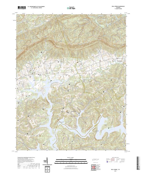
2022 Map of Well Spring
USGS Topo · Published 2022About this map
Powell Valley and the formidable ridges of Cumberland Mountain define this landscape where Campbell, Claiborne, and Union counties meet. This area, largely characterized by the meandering Powell River, features distinctive water-carved geography such as Henegar Bend, Brassfield Bend, and Fullerton Bend. For genealogists, the map is remarkably dense with family burial grounds, including Well Spring Cem, Owens-Claiborne Cem, Hayes Cem, and McNeely Cem, concentrated near the settlement of Speedwell.
Find a feature on this map
86 named features on this map. Tap any name to fly to it.
Don’t see what you’re looking for? This feature index may not catch every label — zoom into the map to look around manually.
Map Details
Editions of this 2022 Well Spring Map
This is the sole edition of this map. No revisions or reprints were ever made.
Other maps of this area

1886 · Cumberland Gap
USGS Topo · 1:125,000

1888 · Cumberland Gap
USGS Topo · 1:125,000

1890 · Williamsburg
USGS Topo · 1:125,000

1891 · Cumberland Gap
USGS Topo · 1:125,000

1893 · Briceville
USGS Topo · 1:125,000

1894 · Williamsburg
USGS Topo · 1:125,000

1895 · Briceville
USGS Topo · 1:125,000

1896 · Briceville
USGS Topo · 1:125,000

1897 · Maynardville
USGS Topo · 1:125,000

1900 · Maynardville
USGS Topo · 1:125,000