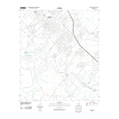
2010 Map of Wellborn
USGS Topo · Published 2010About this map
Texas A and M University anchors the northern portion of this landscape, featuring prominent landmarks such as Kyle Field and the College Station Cemetery. The area reveals a significant academic and athletic footprint, with Easterwood Field situated to the west and several university-managed water resources, including Texas A and M University Lake Number 1. This 2010 survey illustrates the transition from the collegiate core of College Station and Bryan into the more dispersed residential and rural patches of southern Brazos County.
Find a feature on this map
87 named features on this map. Tap any name to fly to it.
Don’t see what you’re looking for? This feature index may not catch every label — zoom into the map to look around manually.
Map Details
Editions of this 2010 Wellborn Map
This is the sole edition of this map. No revisions or reprints were ever made.
Other maps of this area

1913 · Millican
USGS Topo · 1:31,680

1914 · Gay Hill
USGS Topo · 1:62,500

1914 · Navasota
USGS Topo · 1:62,500

1954 · Austin
USGS Topo · 1:250,000

1956 · Bryan
USGS Topo · 1:62,500

1956 · Carlos
USGS Topo · 1:62,500

1959 · Millican
USGS Topo · 1:24,000

1959 · Clay
USGS Topo · 1:24,000

1959 · Reliance
USGS Topo · 1:24,000

1959 · Ferguson Crossing
USGS Topo · 1:24,000