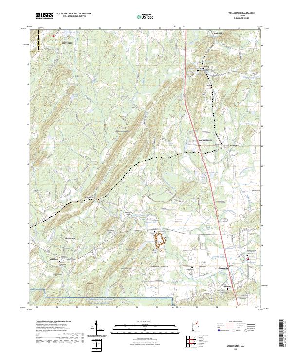
2024 Map of Wellington
USGS Topo · Published 2024About this map
Ohatchee Creek and the Ohatchee Mountains define the northern terrain of this Calhoun County landscape, where small rural communities are linked by historical mill sites and springs. The map documents the persistent agricultural and spiritual centers of the region, anchored by the Alexandria United Methodist Church Cem and Oak Bowery Baptist Church. The southern portion of the sheet is dominated by the NG Pelham Range Training Site Fort McClellan, contrasting the civilian settlement patterns of Lowrimores Crossroads and Middleton with military land use.
Find a feature on this map
165 named features on this map. Tap any name to fly to it.
Don’t see what you’re looking for? This feature index may not catch every label — zoom into the map to look around manually.
Map Details
Editions of this 2024 Wellington Map
This is the sole edition of this map. No revisions or reprints were ever made.
Other maps of this area

1889 · Springville
USGS Topo · 1:125,000

1892 · Springville
USGS Topo · 1:125,000

1900 · Anniston
USGS Topo · 1:125,000

1947 · Anniston
USGS Topo · 1:24,000

1947 · Dunaway Mountain
USGS Topo · 1:24,000

1947 · Ragland
USGS Topo · 1:62,500

1947 · Colvin Gap
USGS Topo · 1:24,000

1947 · Jacksonville
USGS Topo · 1:24,000

1947 · Glencoe
USGS Topo · 1:24,000

1947 · Wellington
USGS Topo · 1:24,000