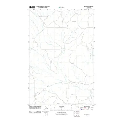
2011 Map of Wellpinit
USGS Topo · Published 2011About this map
The Spokane Indian Reservation landscape is defined by its network of watercourses and the modest settlement of Wellpinit in the early 21st century. High points such as Bottle Ridge, Round Mountain, and Sherwood Mountain anchor the terrain, while the drainage of Cottonwood Creek and Sheep Creek provides a natural structure to the area. A dense network of Bureau of Indian Affairs routes, including BIA Hwy 8 and BIA Hwy 20, facilitates movement across the reservation, connecting local landmarks like Cold Spring to the broader region. The southeastern corner of the map features the Little Chamokane Falls Waterfall along the Little Chamokane Creek, offering a specific point of interest for those studying the hydrography of the Stevens County area.
Find a feature on this map
35 named features on this map. Tap any name to fly to it.
Don’t see what you’re looking for? This feature index may not catch every label — zoom into the map to look around manually.
Map Details
Editions of this 2011 Wellpinit Map
This is the sole edition of this map. No revisions or reprints were ever made.
Other maps of this area

1927 · Chewelah
USGS Topo · 1:125,000

1930 · Chewelah
USGS Topo · 1:125,000

1944 · Wellpinit
USGS Topo · 1:62,500

1948 · Hunters
USGS Topo · 1:62,500

1948 · Turtle Lake
USGS Topo · 1:62,500

1950 · Turtle Lake
USGS Topo · 1:62,500

1950 · Hunters
USGS Topo · 1:62,500

1953 · Wellpinit
USGS Topo · 1:62,500

1953 · Ritzville
USGS Topo · 1:250,000

1954 · Okanogan
USGS Topo · 1:250,000