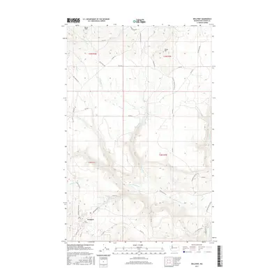
2017 Map of Wellpinit
USGS Topo · Published 2017About this map
Wellpinit serves as the central hub of this modern survey, which details a landscape defined by an extensive Bureau of Indian Affairs (BIA) road network and rugged drainage basins. The settlement is anchored by the Chief Lot Cem, providing a point of interest for genealogists and local historians tracking family sites in the region. The terrain is marked by significant elevation changes, from the heights of Round Mtn and Bottle Ridge down to the complex hydrology of Little Chamokane Cr. This waterway, along with Cottonwood Cr and Sheep Cr, carves through the southern half of the quadrangle. A notable geographic landmark, Little Chamokane Falls, is located in the southeastern quadrant, where the creek descends rapidly. The map also records numerous local transport routes such as Ford-Wellpinit Rd and McCoy Lake Rd, which link scattered residences and natural resources.
Find a feature on this map
41 named features on this map. Tap any name to fly to it.
Don’t see what you’re looking for? This feature index may not catch every label — zoom into the map to look around manually.
Map Details
Editions of this 2017 Wellpinit Map
This is the sole edition of this map. No revisions or reprints were ever made.
Other maps of this area

1927 · Chewelah
USGS Topo · 1:125,000

1930 · Chewelah
USGS Topo · 1:125,000

1944 · Wellpinit
USGS Topo · 1:62,500

1948 · Hunters
USGS Topo · 1:62,500

1948 · Turtle Lake
USGS Topo · 1:62,500

1950 · Turtle Lake
USGS Topo · 1:62,500

1950 · Hunters
USGS Topo · 1:62,500

1953 · Wellpinit
USGS Topo · 1:62,500

1953 · Ritzville
USGS Topo · 1:250,000

1954 · Okanogan
USGS Topo · 1:250,000