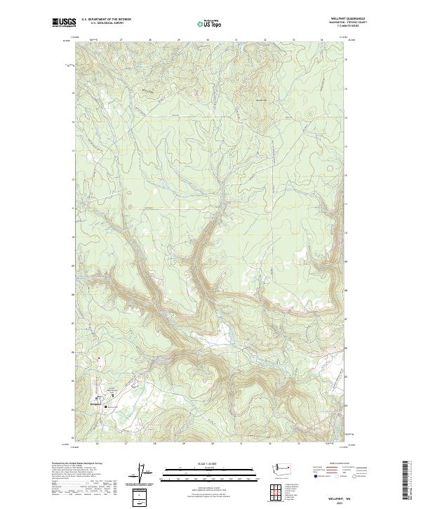
2023 Map of Wellpinit
USGS Topo · Published 2023About this map
Wellpinit serves as the central hub of this Stevens County landscape, where the intersection of BIA Hwy 18 and BIA Hwy 19 anchors a community defined by its connection to the terrain. For those researching local lineages, the Sacred Heart Catholic Cem and Chief Lot Cem are significant cultural landmarks situated near the heart of the settlement. The area's topography is marked by the prominence of Bottle Ridge and Round Mtn, while the drainage of Little Chamokane Creek and its tributary Wellpinit Creek dictates the movement of travel and habitation. At the southeastern edge, the Little Chamokane Falls represents a notable hydrological feature where the creek descends toward the border of the quadrangle. A network of Bureau of Indian Affairs roads, such as BIA Hwy 3 and BIA Hwy 24, weave through the timbered draws and ridgelines, illustrating the modern infrastructure overlaid on this traditional landscape.
Find a feature on this map
41 named features on this map. Tap any name to fly to it.
Don’t see what you’re looking for? This feature index may not catch every label — zoom into the map to look around manually.
Map Details
Editions of this 2023 Wellpinit Map
This is the sole edition of this map. No revisions or reprints were ever made.
Other maps of this area

1927 · Chewelah
USGS Topo · 1:125,000

1930 · Chewelah
USGS Topo · 1:125,000

1944 · Wellpinit
USGS Topo · 1:62,500

1948 · Hunters
USGS Topo · 1:62,500

1948 · Turtle Lake
USGS Topo · 1:62,500

1950 · Turtle Lake
USGS Topo · 1:62,500

1950 · Hunters
USGS Topo · 1:62,500

1953 · Wellpinit
USGS Topo · 1:62,500

1953 · Ritzville
USGS Topo · 1:250,000

1954 · Okanogan
USGS Topo · 1:250,000