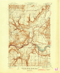
1944 Map of Wellpinit
USGS Topo · Published 1944About this map
The Spokane Indian Reservation dominates this mid-century landscape, centered on the settlement of Wellpinit. The terrain is deeply incised by the Spokane River and the expanse of Long Lake, where the border of Stevens, Lincoln, and Spokane counties meet. Local life in the 1940s is anchored by community landmarks such as St Joseph Ch, the Reservation Sch, and a Cem near Chamokane Creek.
Find a feature on this map
25 named features on this map. Tap any name to fly to it.
Don’t see what you’re looking for? This feature index may not catch every label — zoom into the map to look around manually.
Map Details
Editions of this 1944 Wellpinit Map
2 editions found
Other maps of this area

1927 · Chewelah
USGS Topo · 1:125,000

1930 · Chewelah
USGS Topo · 1:125,000

1943 · Medical Lake
USGS Topo · 1:62,500

1944 · Clayton
USGS Topo · 1:62,500

1944 · Wellpinit
USGS Topo · 1:62,500

1945 · Reardan
USGS Topo · 1:62,500

1948 · Hunters
USGS Topo · 1:62,500

1948 · Turtle Lake
USGS Topo · 1:62,500

1950 · Turtle Lake
USGS Topo · 1:62,500

1950 · Hunters
USGS Topo · 1:62,500