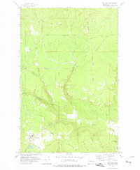
1973 Map of Wellpinit
USGS Topo · Published 1976About this map
Wellpinit serves as the central hub of this 1970s landscape, which lies entirely within the boundary of the Spokane Indian Reservation. The area is defined by a network of named ridge systems and creek drainages, most notably Bottle Ridge and the winding Little Chamokane Creek that cuts through the southern terrain. Local history and genealogy are anchored by the Chief Lot Cem near the town center, while geographical landmarks like Round Mountain and Little Chamokane Falls highlight the natural drainage patterns of the region.
Find a feature on this map
26 named features on this map. Tap any name to fly to it.
Don’t see what you’re looking for? This feature index may not catch every label — zoom into the map to look around manually.
Map Details
Editions of this 1973 Wellpinit Map
This is the sole edition of this map. No revisions or reprints were ever made.
Other maps of this area

1927 · Chewelah
USGS Topo · 1:125,000

1930 · Chewelah
USGS Topo · 1:125,000

1944 · Wellpinit
USGS Topo · 1:62,500

1948 · Hunters
USGS Topo · 1:62,500

1948 · Turtle Lake
USGS Topo · 1:62,500

1950 · Turtle Lake
USGS Topo · 1:62,500

1950 · Hunters
USGS Topo · 1:62,500

1953 · Wellpinit
USGS Topo · 1:62,500

1953 · Ritzville
USGS Topo · 1:250,000

1954 · Okanogan
USGS Topo · 1:250,000