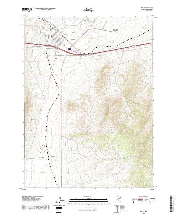
2021 Map of Wells
USGS Topo · Published 2021About this map
Wells serves as a critical high-desert crossroads where the historic water sources of Humboldt Wells meet modern transportation corridors. The town grid is clearly defined by residential streets such as Humboldt Ave and Starr Ave, reaching toward the Wells City Water Reservoir and the Wells City Cem at the foot of the rising terrain. To the east, the Wells Municipal Airport/Harriet Field occupies the level expanse of Town Creek Flat, while the southern landscape is dominated by the prominent elevations of the Wood Hills. This 2021 update shows the modern road network including Clover Valley Rd and Natl Forest Develop Road 098 Rd, which provide access to the outlying reaches of Clover Valley and isolated water points like Railroad Spring.
Find a feature on this map
41 named features on this map. Tap any name to fly to it.
Don’t see what you’re looking for? This feature index may not catch every label — zoom into the map to look around manually.
Map Details
Editions of this 2021 Wells Map
This is the sole edition of this map. No revisions or reprints were ever made.
Other maps of this area

1935 · Halleck
USGS Topo · 1:125,000

1955 · Wells
USGS Topo · 1:250,000

1955 · Elko
USGS Topo · 1:250,000

1958 · Wells
USGS Topo · 1:250,000

1958 · Elko
USGS Topo · 1:250,000

1961 · Wells
USGS Topo · 1:250,000

1962 · Elko
USGS Topo · 1:250,000

1965 · Elko
USGS Topo · 1:250,000

1967 · Welcome
USGS Topo · 1:24,000

1967 · Metropolis
USGS Topo · 1:24,000