
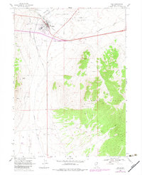
1968 Map of Wells
USGS Topo · Published 1971About this map
Wells serves as a critical rail junction in the late 1960s, where the Southern Pacific, Union Pacific, and Western Pacific lines converge near the headwaters of the Humboldt River. This intersection of major transcontinental railroads defined the town's industrial character, evidenced by the numerous borrow pits, gravel pits, and Substations flanking the tracks. The landscape transitions sharply from the flat expanse of Town Creek Flat to the rising elevations of the Wood Hills in the southeast.
Find a feature on this map
25 named features on this map. Tap any name to fly to it.
Don’t see what you’re looking for? This feature index may not catch every label — zoom into the map to look around manually.
Map Details
Editions of this 1968 Wells Map
2 editions found
Other maps of this area

1935 · Halleck
USGS Topo · 1:125,000

1955 · Wells
USGS Topo · 1:250,000

1955 · Elko
USGS Topo · 1:250,000

1958 · Wells
USGS Topo · 1:250,000

1958 · Elko
USGS Topo · 1:250,000

1961 · Wells
USGS Topo · 1:250,000

1962 · Elko
USGS Topo · 1:250,000

1965 · Elko
USGS Topo · 1:250,000

1967 · Welcome
USGS Topo · 1:24,000

1967 · Metropolis
USGS Topo · 1:24,000