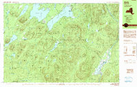
1990 Map of Wells
USGS Topo · Published 1990About this map
Speculator and the surrounding high country of the Adirondack Park define this 1990 survey of Hamilton County. The landscape is dominated by a complex network of glacial water bodies, from the broad Sacandaga Lake and Lake Pleasant to smaller, more secluded waters like Lake Chartreuse and Oxbow Lake. Settlement is concentrated along the river valleys, notably at Wells where the Sacandaga River feeds into Lake Algonquin.
Find a feature on this map
84 named features on this map. Tap any name to fly to it.
Don’t see what you’re looking for? This feature index may not catch every label — zoom into the map to look around manually.
Map Details
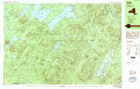
Editions of this 1990 Wells Map
2 editions found
Other maps of this area

1898 · Thirteenth Lake
USGS Topo · 1:62,500

1899 · Indian Lake
USGS Topo · 1:62,500

1900 · Canada Lake
USGS Topo · 1:62,500

1902 · Indian Lake
USGS Topo · 1:62,500

1903 · West Canada Lakes
USGS Topo · 1:62,500

1904 · Piseco Lake
USGS Topo · 1:62,500

1906 · Piseco Lake
USGS Topo · 1:62,500

1907 · Lake Pleasant
USGS Topo · 1:62,500

1908 · Piseco Lake
USGS Topo · 1:62,500

1910 · Stony Creek
USGS Topo · 1:62,500