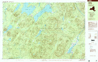
1997 Map of Wells
USGS Topo · Published 1999About this map
Sacandaga Lake and Lake Pleasant dominate this high-elevation landscape within the Adirondack Park, reflecting the region's late-20th-century character as a recreational and wilderness hub. The settlement at Speculator serves as a focal point near the northern shore, while the community of Wells sits further south along the banks of Lake Algonquin. The map illustrates a complex network of water bodies and dramatic topography, from the shoreline of Moffitt Beach to the heights of Dunham Mountain and Fish Mountain. Recreation-based infrastructure is evident through the inclusion of the Snowmobile Trail and Hamilton Lake Trail, alongside the religious and social landmark of Camp of the Woods. Numerous brooks and ponds, such as Sucker Brook and Dunning Pond, feed into the Sacandaga River, showing the intricate drainage patterns of this mountain terrain.
Find a feature on this map
76 named features on this map. Tap any name to fly to it.
Don’t see what you’re looking for? This feature index may not catch every label — zoom into the map to look around manually.
Map Details
Editions of this 1997 Wells Map
This is the sole edition of this map. No revisions or reprints were ever made.
Other maps of this area

1898 · Thirteenth Lake
USGS Topo · 1:62,500

1899 · Indian Lake
USGS Topo · 1:62,500

1900 · Canada Lake
USGS Topo · 1:62,500

1902 · Indian Lake
USGS Topo · 1:62,500

1903 · West Canada Lakes
USGS Topo · 1:62,500

1904 · Piseco Lake
USGS Topo · 1:62,500

1906 · Piseco Lake
USGS Topo · 1:62,500

1907 · Lake Pleasant
USGS Topo · 1:62,500

1908 · Piseco Lake
USGS Topo · 1:62,500

1910 · Stony Creek
USGS Topo · 1:62,500