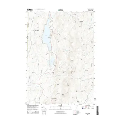
2015 Map of Wells
USGS Topo · Published 2015About this map
Lake Saint Catherine dominates the northern landscape of this Vermont and New York border region, surrounded by a cluster of peaks including Saint Catherine Mtn and Barker Mtn. The settlement of Wells sits south of the lake's narrows, where Wells Brook feeds into Little Lake. This modern survey illustrates the enduring agricultural and residential patterns of the area, with numerous family and community burial sites like Stiles Cem and Barden Cem scattered through the hills and hollows.
Find a feature on this map
106 named features on this map. Tap any name to fly to it.
Don’t see what you’re looking for? This feature index may not catch every label — zoom into the map to look around manually.
Map Details
Editions of this 2015 Wells Map
This is the sole edition of this map. No revisions or reprints were ever made.
Other maps of this area

1893 · Fort Ann
USGS Topo · 1:62,500

1893 · Whitehall
USGS Topo · 1:62,500

1894 · Pawlet
USGS Topo · 1:62,500

1895 · Whitehall
USGS Topo · 1:62,500

1895 · Fort Ann
USGS Topo · 1:62,500

1895 · Castleton
USGS Topo · 1:62,500

1897 · Pawlet
USGS Topo · 1:62,500

1897 · Castleton
USGS Topo · 1:62,500

1898 · Whitehall
USGS Topo · 1:62,500

1898 · Fort Ann
USGS Topo · 1:62,500