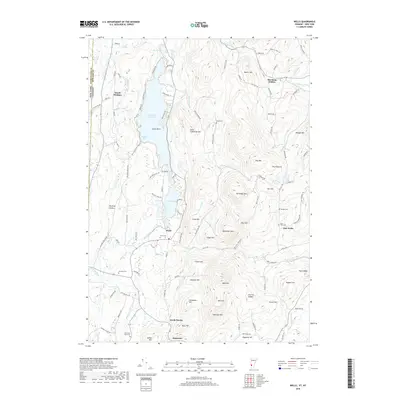
2018 Map of Wells
USGS Topo · Published 2018About this map
Lake Saint Catherine dominates the northern landscape of this survey, with its deep waters framed by Cones Point and Atwater Bay. The village of Wells sits at the southern tip of the lake, where Mill Brook and Wells Brook converge. This area is defined by a dense network of country roads and family-named landmarks that trace the local topography of the Taconic region. The terrain is marked by numerous peaks like Saint Catherine Mtn and Northeast Mtn, while the valleys host small settlements such as East Wells and South Poultney. Local history is preserved through scattered burial grounds including Stiles Cem, Barden Cem, and Blossom Cem. The state line between New York and Vermont runs along the western edge, separating Washington and Rutland counties, while the Mettawee River winds through the southwestern corner near North Pawlet.
Find a feature on this map
107 named features on this map. Tap any name to fly to it.
Don’t see what you’re looking for? This feature index may not catch every label — zoom into the map to look around manually.
Map Details
Editions of this 2018 Wells Map
This is the sole edition of this map. No revisions or reprints were ever made.
Other maps of this area

1893 · Fort Ann
USGS Topo · 1:62,500

1893 · Whitehall
USGS Topo · 1:62,500

1894 · Pawlet
USGS Topo · 1:62,500

1895 · Whitehall
USGS Topo · 1:62,500

1895 · Fort Ann
USGS Topo · 1:62,500

1895 · Castleton
USGS Topo · 1:62,500

1897 · Pawlet
USGS Topo · 1:62,500

1897 · Castleton
USGS Topo · 1:62,500

1898 · Whitehall
USGS Topo · 1:62,500

1898 · Fort Ann
USGS Topo · 1:62,500