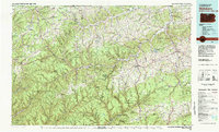
1981 Map of Wellsboro
USGS Topo · Published 1982About this map
Wellsboro serves as the central hub of this northern Pennsylvania landscape, situated near the dramatic incision of the Pine Creek Gorge. Compiled from surveys in the late 1960s and edited in 1981, the map reveals a region defined by massive public land holdings, including the Tioga State Forest and Susquehannock State Forest. The era's infrastructure is marked by the presence of Conrail lines threading through narrow river valleys and the recent development of water management projects like Tioga Reservoir and Hammond Lake on the Tioga River. Smaller settlements like Galeton, Westfield, and Blossburg follow the winding paths of Pine Creek and the Cowanesque River, illustrating a settlement pattern dictated by the steep ridges of Cedar Mountain and Brier Mountain. The inclusion of Leonard Harrison State Park and Colton Point State Park highlights the transition of the gorge area into a significant recreational corridor.
Find a feature on this map
140 named features on this map. Tap any name to fly to it.
Don’t see what you’re looking for? This feature index may not catch every label — zoom into the map to look around manually.
Map Details
Editions of this 1981 Wellsboro Map
This is the sole edition of this map. No revisions or reprints were ever made.
Other maps of this area

1895 · Elmira
USGS Topo · 1:62,500

1899 · Gaines
USGS Topo · 1:62,500

1900 · Gaines
USGS Topo · 1:62,500

1900 · Tioga
USGS Topo · 1:62,500

1900 · Elkland
USGS Topo · 1:62,500

1902 · Tioga
USGS Topo · 1:62,500

1905 · Watkins Glen
USGS Topo · 1:125,000

1914 · Corning
USGS Topo · 1:62,500

1921 · Trout Run
USGS Topo · 1:62,500

1923 · Trout Run
USGS Topo · 1:62,500