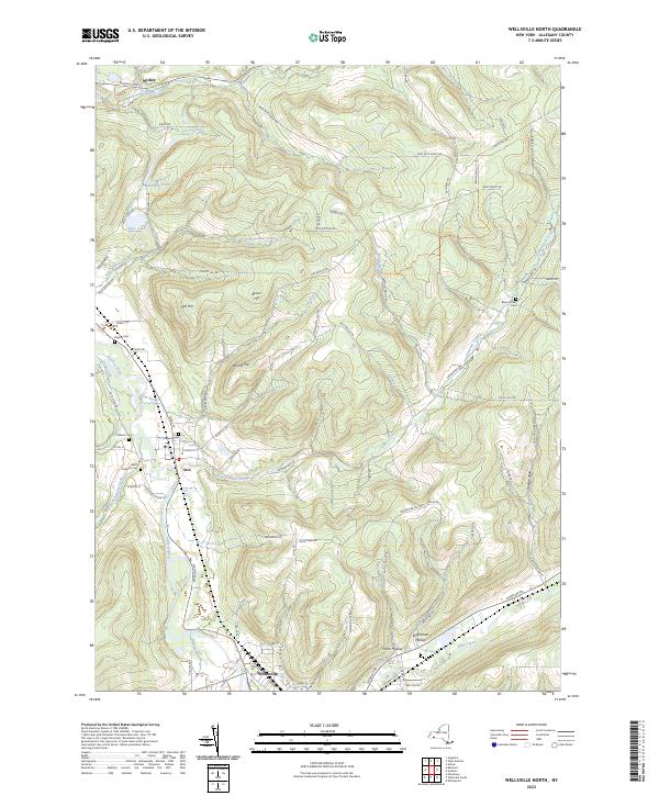
2023 Map of Wellsville North
USGS Topo · Published 2023About this map
The Genesee River serves as the primary corridor through this portion of Allegany County, where the settlement of Scio sits at the confluence with Vandermark Creek and Knight Creek. This landscape is defined by its deep hollows and prominent rises, including Round Top and Oak Hill, which overlook a network of tributary streams such as Plum Bottom Creek and Phillips Creek. For genealogists, the map is remarkably detailed in its documentation of rural burial sites, including the Black Tucker Cem, Fairlawn Cem, and Saint Joseph's Cem. Small communities like Withey in the north and the nearby Smith Hollow to the south reflect the region's enduring rural character, while landmarks like Amity Lake and Saunders Pond highlight the local water resources that have shaped the area's development.
Find a feature on this map
88 named features on this map. Tap any name to fly to it.
Don’t see what you’re looking for? This feature index may not catch every label — zoom into the map to look around manually.
Map Details
Editions of this 2023 Wellsville North Map
This is the sole edition of this map. No revisions or reprints were ever made.
Other maps of this area

1906 · Angelica
USGS Topo · 1:62,500

1916 · Canaseraga
USGS Topo · 1:62,500

1925 · Belmont
USGS Topo · 1:62,500

1926 · Wellsville
USGS Topo · 1:62,500

1939 · Belmont
USGS Topo · 1:62,500

1940 · Canaseraga
USGS Topo · 1:62,500

1941 · Angelica
USGS Topo · 1:62,500

1950 · Elmira
USGS Topo · 1:250,000

1958 · Elmira
USGS Topo · 1:250,000

1960 · Buffalo
USGS Topo · 1:250,000