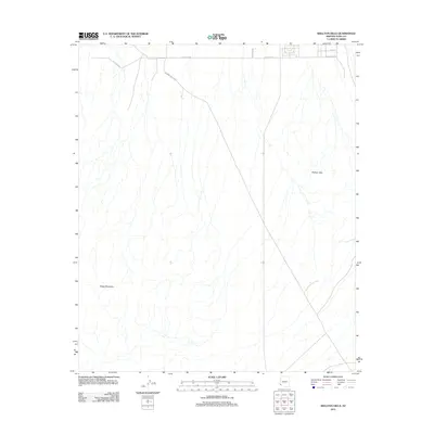
2011 Map of Wellton Hills
USGS Topo · Published 2011About this map
Camino Del Diablo cuts diagonally across this arid landscape, following an ancient corridor through the Sonoran Desert. The map focuses on the stark transition between the flat valley floor and the prominent geological formations of the Wellton Hills and Sheep Mountain. While the southern portion of the quadrangle remains largely open desert terrain defined by dry washes, the northern edge reveals the early 21st-century expansion of the local road network. Gridded routes such as E Co Hwy 14th, E Co 14th St, and Cecil St signify the encroaching development near the community of Wellton, providing a clear record of how modern infrastructure interfaces with the traditional desert paths of Yuma County.
Find a feature on this map
7 named features on this map. Tap any name to fly to it.
Don’t see what you’re looking for? This feature index may not catch every label — zoom into the map to look around manually.
Map Details
Editions of this 2011 Wellton Hills Map
This is the sole edition of this map. No revisions or reprints were ever made.
Other maps of this area

1926 · Fortuna
USGS Topo · 1:62,500

1926 · Wellton
USGS Topo · 1:62,500

1929 · Fortuna
USGS Topo · 1:62,500

1929 · Wellton
USGS Topo · 1:62,500

1942 · Yuma
USGS Topo · 1:250,000

1954 · El Centro
USGS Topo · 1:250,000

1955 · El Centro
USGS Topo · 1:250,000

1958 · El Centro
USGS Topo · 1:250,000

1961 · El Centro
USGS Topo · 1:250,000

1964 · El Centro
USGS Topo · 1:250,000