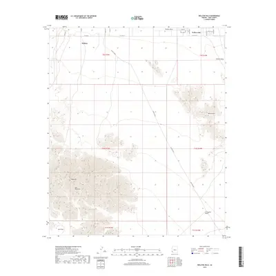
2018 Map of Wellton Hills
USGS Topo · Published 2018About this map
Wellton occupies the northern edge of this arid landscape, where the southern reaches of the Mohawk Valley transition into the sharp relief of the Gila Mountains. The terrain is defined by extreme elevation changes, rising from the Davis Plain toward the summit of Sheep Mtn. A significant portion of the sheet is dominated by the Wellton Hills, a complex geological formation that stands between the valley floor and the vast Lechuguilla Desert to the southeast. The historic Cam Del Diablo cuts a diagonal path across the desert floor, tracing a traditional travel route through this corner of Yuma County. Modern infrastructure is concentrated around the township, with residential roads like S Cecil Circle and Steinly Ave branching off from E Co 14th St, reflecting the managed growth of this desert community.
Find a feature on this map
26 named features on this map. Tap any name to fly to it.
Don’t see what you’re looking for? This feature index may not catch every label — zoom into the map to look around manually.
Map Details
Editions of this 2018 Wellton Hills Map
This is the sole edition of this map. No revisions or reprints were ever made.
Other maps of this area

1926 · Fortuna
USGS Topo · 1:62,500

1926 · Wellton
USGS Topo · 1:62,500

1929 · Fortuna
USGS Topo · 1:62,500

1929 · Wellton
USGS Topo · 1:62,500

1942 · Yuma
USGS Topo · 1:250,000

1954 · El Centro
USGS Topo · 1:250,000

1955 · El Centro
USGS Topo · 1:250,000

1958 · El Centro
USGS Topo · 1:250,000

1961 · El Centro
USGS Topo · 1:250,000

1964 · El Centro
USGS Topo · 1:250,000