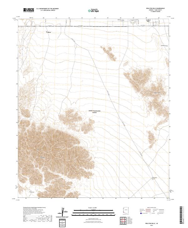
2021 Map of Wellton Hills
USGS Topo · Published 2021About this map
Wellton and the neighboring Wellton Hills sit at the northern edge of this arid landscape where agricultural development meets the desert. The terrain transitions from the low-lying Mohawk Valley into the striking verticality of the Gila Mountains, dominated by the high point of Sheep Mtn. A significant portion of the sheet is occupied by the expansive Lechuguilla Desert and Davis Plain, regions defined by their isolation and historical crossing paths. The legendary Cam Del Diablo cuts diagonally across the basin, tracing a route through the open flats. This modern survey reflects the enduring geography of the Yuma County desert, where contemporary road names like CO 14th St intersect with historic trails and the natural barriers of the desert ranges.
Find a feature on this map
16 named features on this map. Tap any name to fly to it.
Don’t see what you’re looking for? This feature index may not catch every label — zoom into the map to look around manually.
Map Details
Editions of this 2021 Wellton Hills Map
This is the sole edition of this map. No revisions or reprints were ever made.
Other maps of this area

1926 · Fortuna
USGS Topo · 1:62,500

1926 · Wellton
USGS Topo · 1:62,500

1929 · Fortuna
USGS Topo · 1:62,500

1929 · Wellton
USGS Topo · 1:62,500

1942 · Yuma
USGS Topo · 1:250,000

1954 · El Centro
USGS Topo · 1:250,000

1955 · El Centro
USGS Topo · 1:250,000

1958 · El Centro
USGS Topo · 1:250,000

1961 · El Centro
USGS Topo · 1:250,000

1964 · El Centro
USGS Topo · 1:250,000