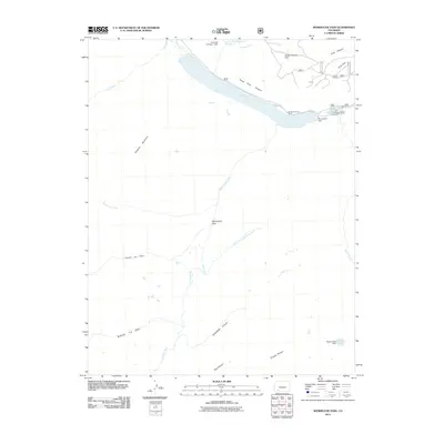
2011 Map of Weminuche Pass
USGS Topo · Published 2011About this map
Weminuche Pass serves as a critical divide in this high-altitude landscape where the headwaters of the Rio Grande meet the drainage of the Los Pinos River. This 2011 survey captures a region defined by water management and wilderness recreation, anchored by the massive Rio Grande Reservoir and its associated Rio Grande Dam. The presence of Fuchs Ditch and multiple reservoir structures, including the Squaw Lake Dam, illustrates the engineering required to harness snowmelt in the San Juan Mountains. Cultural landmarks like Stage Station Flat and Horse Thief Pasture suggest a history of early transit and livestock grazing, while modern access is maintained through Co RD 18 and the Thirtymile Campground. The terrain is marked by steep glacial features such as Snowslide Canyon and Rincon La Vaca.
Find a feature on this map
30 named features on this map. Tap any name to fly to it.
Don’t see what you’re looking for? This feature index may not catch every label — zoom into the map to look around manually.
Map Details
Editions of this 2011 Weminuche Pass Map
This is the sole edition of this map. No revisions or reprints were ever made.
Other maps of this area

1905 · San Cristobal
USGS Topo · 1:125,000

1907 · San Cristobal
USGS Topo · 1:125,000

1945 · Durango
USGS Topo · 1:250,000

1953 · Durango
USGS Topo · 1:250,000

1954 · Durango
USGS Topo · 1:250,000

1959 · Bristol Head
USGS Topo · 1:62,500

1961 · Durango
USGS Topo · 1:250,000

1963 · Durango
USGS Topo · 1:250,000
1964 · Rio Grande Pyramid
USGS Topo · 1:24,000
1964 · Finger Mesa
USGS Topo · 1:24,000