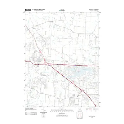
2012 Map of Wentzville
USGS Topo · Published 2012About this map
Wentzville stands as the central hub of this Missouri landscape, where major transport corridors intersect amidst rapidly developing suburban and rural communities. The map detail highlights the expansion of Lake Saint Louis and its intricate shoreline, contrasted by the enduring footprints of older settlements like Flint Hill, Josephville, and Enon. Waterways such as Peruque Creek and McCoy Creek define the natural drainage patterns that shaped early land use in St. Charles County. Local history is grounded in specific sites such as Linn Cemetery and the recreational space at Strutman Field. The transition from rural agriculture to residential subdivisions is evident in the dense network of local roads like Swaying Oaks Rd and Kersting Farms Dr, which branch out from established centers like Gilmore and Dardenne.
Find a feature on this map
127 named features on this map. Tap any name to fly to it.
Don’t see what you’re looking for? This feature index may not catch every label — zoom into the map to look around manually.
Map Details
Editions of this 2012 Wentzville Map
This is the sole edition of this map. No revisions or reprints were ever made.
Other maps of this area

1903 · O'Fallon
USGS Topo · 1:125,000

1931 · Brussels
USGS Topo · 1:62,500

1937 · Weldon Spring
USGS Topo · 1:24,000

1939 · Brussels
USGS Topo · 1:62,500

1940 · Weldon Spring
USGS Topo · 1:24,000

1941 · Troy
USGS Topo · 1:62,500

1943 · Brussels
USGS Topo · 1:62,500

1945 · Troy
USGS Topo · 1:62,500

1948 · Augusta
USGS Topo · 1:62,500

1949 · Saint Louis
USGS Topo · 1:250,000