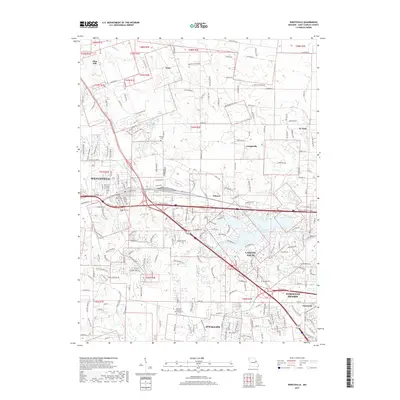
2017 Map of Wentzville
USGS Topo · Published 2017About this map
Wentzville and the surrounding Saint Charles County landscape appear here in high-resolution detail during a period of significant suburban expansion. The western edge of the metropolitan region is defined by the branching waters of Peruque Creek and Lake Saint Louis, while the older agricultural roots of the area are still visible in smaller settlements like Josephville, Gilmore, and Flint Hill. Local history is well-preserved through the mapping of the Saint Patrick Church and its adjacent Saint Patrick Cem, alongside the Hopewell Missionary Baptist Church further south in O'Fallon. This 2017 study illustrates the complex road network, from the major thoroughfares of the Interstate to residential developments like Meadow Brook Ests. The map provides a clear look at the transitional landscape between the dense core of Dardenne Prairie and the quieter, creek-carved terrain of Enon and the Silver Spring Creek valley.
Find a feature on this map
118 named features on this map. Tap any name to fly to it.
Don’t see what you’re looking for? This feature index may not catch every label — zoom into the map to look around manually.
Map Details
Editions of this 2017 Wentzville Map
This is the sole edition of this map. No revisions or reprints were ever made.
Other maps of this area

1903 · O'Fallon
USGS Topo · 1:125,000

1931 · Brussels
USGS Topo · 1:62,500

1937 · Weldon Spring
USGS Topo · 1:24,000

1939 · Brussels
USGS Topo · 1:62,500

1940 · Weldon Spring
USGS Topo · 1:24,000

1941 · Troy
USGS Topo · 1:62,500

1943 · Brussels
USGS Topo · 1:62,500

1945 · Troy
USGS Topo · 1:62,500

1948 · Augusta
USGS Topo · 1:62,500

1949 · Saint Louis
USGS Topo · 1:250,000