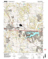
2000 Map of Wentzville
USGS Topo · Published 2003About this map
Wentzville and its surrounding St. Charles County communities are captured at a point of significant suburban expansion at the turn of the 21st century. The landscape is defined by the rapid growth of Lake Saint Louis and O'Fallon, where modern residential patterns and golf courses contrast with the older agricultural foundations of the region. Traces of the area's rural past remain visible in the small settlements of Flint Hill, Enon, and Josephville, along with local landmarks like Linn Cem and Weldon Spring Ch. The drainage patterns of Perugue Creek and McCoy Creek weave through the terrain, though they are increasingly interrupted by large-scale infrastructure like the Sewage Disposal Pond and expanding corporate boundaries. This survey documents the era when the traditional crossroads of Gilmore were being superseded by the maturing infrastructure of the modern Missouri suburbs.
Find a feature on this map
29 named features on this map. Tap any name to fly to it.
Don’t see what you’re looking for? This feature index may not catch every label — zoom into the map to look around manually.
Map Details
Editions of this 2000 Wentzville Map
This is the sole edition of this map. No revisions or reprints were ever made.
Other maps of this area

1903 · O'Fallon
USGS Topo · 1:125,000

1931 · Brussels
USGS Topo · 1:62,500

1937 · Weldon Spring
USGS Topo · 1:24,000

1939 · Brussels
USGS Topo · 1:62,500

1940 · Weldon Spring
USGS Topo · 1:24,000

1941 · Troy
USGS Topo · 1:62,500

1943 · Brussels
USGS Topo · 1:62,500

1945 · Troy
USGS Topo · 1:62,500

1948 · Augusta
USGS Topo · 1:62,500

1949 · Saint Louis
USGS Topo · 1:250,000