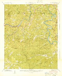
1940 Map of Wesser
USGS Topo · Published 1940About this map
Nantahala Gorge serves as the dramatic centerpiece of this 1940 survey, where the Nantahala River and the Southern Railway parallel one another through the deep mountain passes of the Nantahala National Forest. The map documents a landscape defined by isolated homesteads and small mountain communities like Wesser, Needmore, and Almond just before the mid-century. Significant for genealogy and local history, it identifies the locations of the Watia Ch, Wesser Ch, and several family cemeteries such as Tabor Cem and Breedlove Cem.
Find a feature on this map
128 named features on this map. Tap any name to fly to it.
Don’t see what you’re looking for? This feature index may not catch every label — zoom into the map to look around manually.
Map Details
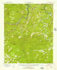
Editions of this 1940 Wesser Map
2 editions found
Other maps of this area

1891 · Cowee
USGS Topo · 1:125,000

1897 · Cowee
USGS Topo · 1:125,000

1907 · Cowee
USGS Topo · 1:125,000

1933 · Bryson
USGS Topo · 1:62,500

1933 · Bushnell
USGS Topo · 1:62,500

1935 · Franklin
USGS Topo · 1:24,000

1935 · Burningtown Bald
USGS Topo · 1:24,000

1935 · Topton
USGS Topo · 1:24,000

1935 · Wayah Bald
USGS Topo · 1:48,000

1936 · Proctor
USGS Topo · 1:24,000