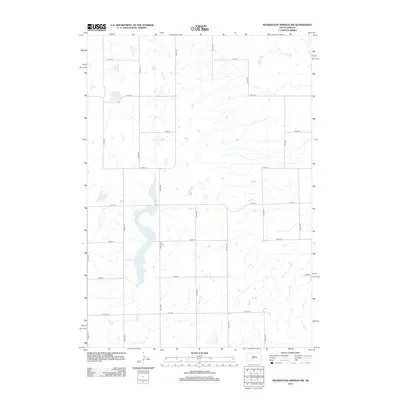
2012 Map of Wessington Springs NW
USGS Topo · Published 2012About this map
Long Lake dominates this section of the prairie, stretching vertically through the center of the terrain as the primary water feature of the region. Feeding into the southern reaches of the lake is Smith Cr, which meanders through the landscape toward the Jerauld County interior. This 2012 survey reveals the systematic organization of the Dakota plains, defined by a rigid grid of numbered routes like 374th Ave and 222nd St. The land use appears primarily agricultural, with small ephemeral wetlands and depressions scattered between the north-south avenues and east-west streets, illustrating how natural drainage patterns persist despite the human-imposed geometry of the township survey system.
Find a feature on this map
17 named features on this map. Tap any name to fly to it.
Don’t see what you’re looking for? This feature index may not catch every label — zoom into the map to look around manually.
Map Details
Editions of this 2012 Wessington Springs NW Map
This is the sole edition of this map. No revisions or reprints were ever made.
Other maps of this area

1949 · Vayland SE
USGS Topo · 1:24,000

1951 · Wessington SE
USGS Topo · 1:24,000

1951 · Wessington SW
USGS Topo · 1:24,000

1951 · Vayland SE
USGS Topo · 1:24,000

1953 · Huron
USGS Topo · 1:250,000

1954 · Huron
USGS Topo · 1:250,000

1973 · Wessington Springs NE
USGS Topo · 1:24,000

1973 · Cottonwood Lake
USGS Topo · 1:24,000

1973 · Wessington Springs
USGS Topo · 1:24,000

1973 · Wessington Springs NW
USGS Topo · 1:24,000