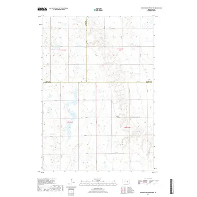
2017 Map of Wessington Springs NW
USGS Topo · Published 2017About this map
Chery Township Pioneer Cem serves as a lone historical marker in this rural landscape where Hand, Beadle, and Jerauld counties converge. The terrain is defined by its drainage patterns and glacial depressions, most notably the central waters of Long Lake and the southern flow of Smith Cr. This 2017 survey illustrates the enduring grid of the Public Land Survey System, with township and range lines like t109n r66w and t108n r65w organizing the prairie into a network of section-line roads such as 375th Ave and 220th St. The scarcity of named settlements highlights a region dedicated almost entirely to agriculture, where local history is anchored by the isolated burial grounds and the natural hydrologic features that have dictated land use for generations.
Find a feature on this map
27 named features on this map. Tap any name to fly to it.
Don’t see what you’re looking for? This feature index may not catch every label — zoom into the map to look around manually.
Map Details
Editions of this 2017 Wessington Springs NW Map
This is the sole edition of this map. No revisions or reprints were ever made.
Other maps of this area

1949 · Vayland SE
USGS Topo · 1:24,000

1951 · Wessington SE
USGS Topo · 1:24,000

1951 · Wessington SW
USGS Topo · 1:24,000

1951 · Vayland SE
USGS Topo · 1:24,000

1953 · Huron
USGS Topo · 1:250,000

1954 · Huron
USGS Topo · 1:250,000

1973 · Wessington Springs NE
USGS Topo · 1:24,000

1973 · Cottonwood Lake
USGS Topo · 1:24,000

1973 · Wessington Springs
USGS Topo · 1:24,000

1973 · Wessington Springs NW
USGS Topo · 1:24,000