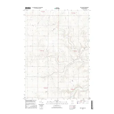
2016 Map of West Albany
USGS Topo · Published 2016About this map
The Zumbro River cuts through the southeastern corner of this Wabasha County landscape, where the deeply carved terrain of the Driftless Area is defined by narrow valleys and prominent high ground. Waterways such as Spring Cr have shaped the land into a series of named landforms, including the evocative Hungry Hollow, Hell Coulee, and Hurley Ravine. These steep-walled features frame the agricultural tablelands above, where a network of section-line roads like 630th St and 299th Ave connects dispersed farmsteads and rural landmarks.
Find a feature on this map
27 named features on this map. Tap any name to fly to it.
Don’t see what you’re looking for? This feature index may not catch every label — zoom into the map to look around manually.
Map Details
Editions of this 2016 West Albany Map
This is the sole edition of this map. No revisions or reprints were ever made.
Other maps of this area

1932 · Wabasha
USGS Topo · 1:62,500

1934 · Plainview
USGS Topo · 1:62,500

1935 · Rochester
USGS Topo · 1:48,000

1938 · Plainview
USGS Topo · 1:62,500

1939 · Rochester
USGS Topo · 1:62,500

1951 · Wabasha
USGS Topo · 1:62,500

1951 · Lake City
USGS Topo · 1:62,500

1953 · Saint Paul
USGS Topo · 1:250,000

1959 · Saint Paul
USGS Topo · 1:250,000
1972 · Plainview
USGS Topo · 1:24,000