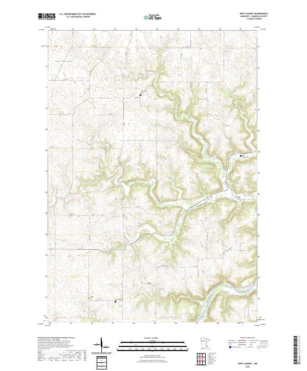
2022 Map of West Albany
USGS Topo · Published 2022About this map
Irish Ridge and its deeply carved drainages define this portion of the driftless area in Wabasha County. The landscape is characterized by a high plateau deeply incised by watercourses such as Spring Cr and the Zumbro River. These sharp elevation changes are evidenced by named topographic features including Hungry Hollow, Hell Coulee, and Hurley Ravine. Settlement is focused primarily along the ridge tops and valley floors where roads like Co RD 11 and Co RD 72 follow the natural contours of the land.
Find a feature on this map
29 named features on this map. Tap any name to fly to it.
Don’t see what you’re looking for? This feature index may not catch every label — zoom into the map to look around manually.
Map Details
Editions of this 2022 West Albany Map
This is the sole edition of this map. No revisions or reprints were ever made.
Other maps of this area

1932 · Wabasha
USGS Topo · 1:62,500

1934 · Plainview
USGS Topo · 1:62,500

1935 · Rochester
USGS Topo · 1:48,000

1938 · Plainview
USGS Topo · 1:62,500

1939 · Rochester
USGS Topo · 1:62,500

1951 · Wabasha
USGS Topo · 1:62,500

1951 · Lake City
USGS Topo · 1:62,500

1953 · Saint Paul
USGS Topo · 1:250,000

1959 · Saint Paul
USGS Topo · 1:250,000
1972 · Plainview
USGS Topo · 1:24,000