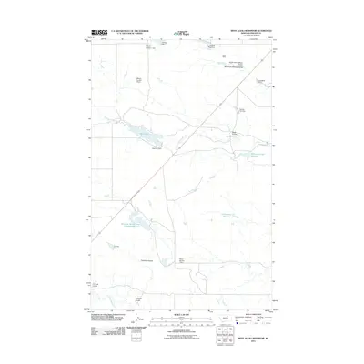
2011 Map of West Alkali Reservoir
USGS Topo · Published 2011About this map
West Alkali Creek and its complex system of agricultural water management define this landscape in north-central Montana. The map reveals an intricate network of coulees and earthen dams designed to capture runoff in a semi-arid environment, with named structures like the W B Black Dam, Mitchell One Dam, and Halvor Number 1 Dam indicating local family or ranching history. US Route 191 bisects the terrain, providing the primary corridor through this ranchland. Significant catchments including West Alkali Reservoir, Williams Coulee Reservoir, and the uniquely titled Reservoir Number One Hundred Sixty-one demonstrate the vital importance of water storage for the local economy. The drainage patterns of Threemile Coulee and Fourmile Coulee suggest a topographic rhythm that has dictated land use and road placement for generations.
Find a feature on this map
23 named features on this map. Tap any name to fly to it.
Don’t see what you’re looking for? This feature index may not catch every label — zoom into the map to look around manually.
Map Details
Editions of this 2011 West Alkali Reservoir Map
This is the sole edition of this map. No revisions or reprints were ever made.
Other maps of this area

1953 · Havre
USGS Topo · 1:250,000

1954 · Glasgow
USGS Topo · 1:250,000

1957 · Glasgow
USGS Topo · 1:250,000

1957 · Havre
USGS Topo · 1:250,000

1958 · Glasgow
USGS Topo · 1:250,000

1958 · Havre
USGS Topo · 1:250,000

1964 · Cow Creek
USGS Topo · 1:24,000

1965 · Wagner
USGS Topo · 1:24,000

1965 · West Alkali Reservoir
USGS Topo · 1:24,000

1965 · Phillips
USGS Topo · 1:24,000