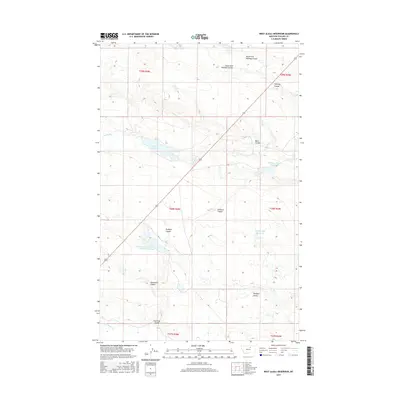
2017 Map of West Alkali Reservoir
USGS Topo · Published 2017About this map
W Alkali Reservoir and several other managed water catchments sit within this section of Phillips County, Montana, illustrating the critical role of water storage in this arid northern plains landscape. The drainage system is defined by numerous coulees, such as North Fork Halfway Coulee and South Fork Halfway Coulee to the north, which converge to manage seasonal runoff. The inclusion of Reservoir Number One Hundred Sixty-one and Partnership Reservoir suggests a highly organized approach to resource management, likely supporting local livestock or agriculture in the sprawling terrain of Rudolph Valley. US Route 191 serves as the primary artery through the area, intersecting the coulees and connecting these remote water features. The naming conventions, including Rudolph Coulee and Williams Coulee, often reflect the early families or figures associated with the surveying and settlement of these high plains.
Find a feature on this map
21 named features on this map. Tap any name to fly to it.
Don’t see what you’re looking for? This feature index may not catch every label — zoom into the map to look around manually.
Map Details
Editions of this 2017 West Alkali Reservoir Map
This is the sole edition of this map. No revisions or reprints were ever made.
Other maps of this area

1953 · Havre
USGS Topo · 1:250,000

1954 · Glasgow
USGS Topo · 1:250,000

1957 · Glasgow
USGS Topo · 1:250,000

1957 · Havre
USGS Topo · 1:250,000

1958 · Glasgow
USGS Topo · 1:250,000

1958 · Havre
USGS Topo · 1:250,000

1964 · Cow Creek
USGS Topo · 1:24,000

1965 · Wagner
USGS Topo · 1:24,000

1965 · West Alkali Reservoir
USGS Topo · 1:24,000

1965 · Phillips
USGS Topo · 1:24,000