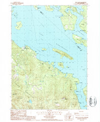
1987 Map of West Alton
USGS Topo · Published 1987About this map
Lake The Broads Winnipesaukee dominates this 1980s topography, illustrating the intricate shoreline and island chains of central New Hampshire. The map details the developed waterfronts of Tuftonboro Neck and Wolfeboro Neck, where established summer camps and communities like Sandy Island Camp and Keewayden are prominent. Along the southwestern shore, the terrain rises sharply from West Alton toward the peaks of Mt Major and Straightback Mountain, revealing a landscape of managed conservation and recreation including Belknap Mountain State Forest and Ellacoya State Park. A notable insight is the presence of the Mt Washington Boat Route, which highlights the historical and ongoing importance of waterborne transit connecting points like Diamond Island and Rattlesnake Island to mainland settlements. Several small cemeteries are marked near the Alton Brook valley, providing valuable data for local genealogists tracking the area's older families.
Find a feature on this map
72 named features on this map. Tap any name to fly to it.
Don’t see what you’re looking for? This feature index may not catch every label — zoom into the map to look around manually.
Map Details
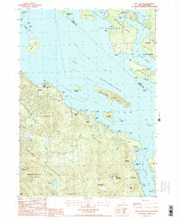
Editions of this 1987 West Alton Map
2 editions found
Other maps of this area

1909 · Winnepesaukee
USGS Topo · 1:62,500

1919 · Gilmanton
USGS Topo · 1:62,500

1919 · Alton
USGS Topo · 1:62,500

1927 · Gilmanton
USGS Topo · 1:62,500

1928 · Wolfeboro
USGS Topo · 1:62,500

1949 · Portland
USGS Topo · 1:250,000

1956 · Winnipesaukee
USGS Topo · 1:62,500

1956 · Portland
USGS Topo · 1:250,000

1957 · Alton
USGS Topo · 1:62,500
1957 · Gilmanton
USGS Topo · 1:62,500