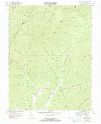
1967 Map of West Augusta
USGS Topo · Published 1991About this map
West Augusta sits at the southern edge of this mid-century survey, a vital point where the Calfpasture River begins its course through the mountain valleys. The landscape is dominated by the dense terrain of the George Washington National Forest, defined by high elevations like Hardscrabble Knob and Tearjacket Knob. This area reflects a long history of forest management and early mountain settlement, where remote outposts like Camp Todd served as basepoints for navigating the ridges.
Find a feature on this map
77 named features on this map. Tap any name to fly to it.
Don’t see what you’re looking for? This feature index may not catch every label — zoom into the map to look around manually.
Map Details
Editions of this 1967 West Augusta Map
2 editions found
Other maps of this area

1894 · Staunton
USGS Topo · 1:125,000

1924 · Mc Dowell
USGS Topo · 1:62,500

1943 · Craigsville
USGS Topo · 1:62,500

1944 · Parnassus
USGS Topo · 1:62,500

1944 · Mc Dowell
USGS Topo · 1:62,500

1944 · Staunton
USGS Topo · 1:62,500

1945 · Craigsville
USGS Topo · 1:62,500

1946 · Mc Dowell
USGS Topo · 1:62,500

1947 · Staunton
USGS Topo · 1:62,500

1947 · Parnassus
USGS Topo · 1:62,500