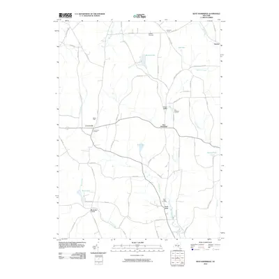
2010 Map of West Bainbridge
USGS Topo · Published 2010About this map
Coventryville and West Bainbridge anchor this rural Chenango County landscape, where small hamlets are connected by a network of winding roads like Co Rd 17 and Shapley Rd. The topography is defined by significant elevations such as Gibson Pinnacle, with numerous waterways including Kelsey Creek, Wilkins Brook, and Cheshire Creek carving through the valleys. The map reveals a deeply rooted community structure, emphasized by several generational burial grounds such as the Coventryville Cemetery, West Bainbridge Cemetery, and North Afton Cemetery.
Find a feature on this map
66 named features on this map. Tap any name to fly to it.
Don’t see what you’re looking for? This feature index may not catch every label — zoom into the map to look around manually.
Map Details
Editions of this 2010 West Bainbridge Map
This is the sole edition of this map. No revisions or reprints were ever made.
Other maps of this area

1902 · Coventry
USGS Topo · 1:62,500

1904 · Oxford
USGS Topo · 1:62,500

1905 · Nineveh
USGS Topo · 1:62,500

1915 · Unadilla
USGS Topo · 1:62,500

1918 · Unadilla
USGS Topo · 1:62,500

1924 · Deposit
USGS Topo · 1:62,500

1926 · Deposit
USGS Topo · 1:62,500

1943 · Sidney
USGS Topo · 1:24,000
1943 · Guilford
USGS Topo · 1:24,000

1944 · Deposit
USGS Topo · 1:62,500