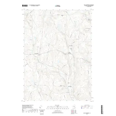
2019 Map of West Bainbridge
USGS Topo · Published 2019About this map
Coventryville and West Bainbridge anchor this portion of Chenango County, where the landscape is defined by the rolling drainages of Wilkins Brook and Kelsey Creek. This 2019 survey captures the enduring rural character of the region, marked by numerous small cemeteries such as Yaleville Cem and North Afton Cem, which serve as vital touchpoints for local genealogy and family history research. The terrain is crisscrossed by a network of named roads like Cheese Factory Rd and Blakesley Nurse Hollow Rd, hinting at the agricultural and timber-linked heritage of the area. Notable landmarks including the North Fork Airport and high points like Gibson Pinnacle provide clear orientation amidst the patchwork of woodlots and fields. Small water bodies like Echo Lake and Mud Pond are scattered throughout the hills, illustrating the glacial topography that shapes the local environment.
Find a feature on this map
66 named features on this map. Tap any name to fly to it.
Don’t see what you’re looking for? This feature index may not catch every label — zoom into the map to look around manually.
Map Details
Editions of this 2019 West Bainbridge Map
This is the sole edition of this map. No revisions or reprints were ever made.
Other maps of this area

1902 · Coventry
USGS Topo · 1:62,500

1904 · Oxford
USGS Topo · 1:62,500

1905 · Nineveh
USGS Topo · 1:62,500

1915 · Unadilla
USGS Topo · 1:62,500

1918 · Unadilla
USGS Topo · 1:62,500

1924 · Deposit
USGS Topo · 1:62,500

1926 · Deposit
USGS Topo · 1:62,500

1943 · Sidney
USGS Topo · 1:24,000
1943 · Guilford
USGS Topo · 1:24,000

1944 · Deposit
USGS Topo · 1:62,500