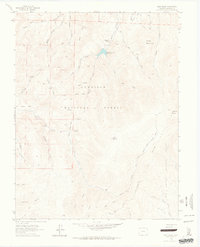
1962 Map of West Baldy
USGS Topo · Published 1964About this map
The Continental Divide winds through this high-altitude landscape along the border of the Gunnison National Forest and Rio Grande National Forest. This 1962 field-checked survey reveals a remote wilderness defined by water and high peaks, where numerous headwaters like Right Hand Barret Creek and Needle Creek begin their descent. A notable human element in this isolation is the Hughes Mine, accompanied by the Hughes Mine Grave, signifying the solitary and often harsh life of early prospectors in these mountains.
Find a feature on this map
38 named features on this map. Tap any name to fly to it.
Don’t see what you’re looking for? This feature index may not catch every label — zoom into the map to look around manually.
Map Details
Editions of this 1962 West Baldy Map
3 editions found
Other maps of this area

1956 · Montrose
USGS Topo · 1:250,000

1959 · Montrose
USGS Topo · 1:250,000

1960 · Montrose
USGS Topo · 1:250,000

1962 · Doyleville
USGS Topo · 1:24,000

1962 · West Baldy
USGS Topo · 1:24,000

1962 · Houston Gulch
USGS Topo · 1:24,000

1962 · Razor Creek Dome
USGS Topo · 1:24,000

1964 · Sargents
USGS Topo · 1:24,000
1967 · North Pass
USGS Topo · 1:24,000

1967 · Sargents Mesa
USGS Topo · 1:24,000