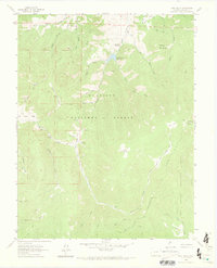
1962 Map of West Baldy
USGS Topo · Published 1973About this map
The Continental Divide snake across this high-elevation landscape in the early 1960s, marking the boundary between the Gunnison National Forest and the Rio Grande National Forest. Dominating the terrain are the prominent peaks of West Baldy and Middle Baldy, alongside the distinctive formation of Needle Rock. A network of pack and jeep trails provides access to this backcountry, which supported sparse human activity centered on mining and high-country grazing. Evidence of early prospectors remains with the Hughes Mine Grave, a site of significant local history value. Water management in this high-altitude environment is anchored by the Needle Creek Reservoir, which collects runoff from several drainage systems, including Upper Left Hand Needle Creek and Needle Creek. Small-scale structures like Shortys Cabin and the site at Lujan are located in the southern reaches, connected by drainages such as Razor Creek and King Gulch.
Find a feature on this map
31 named features on this map. Tap any name to fly to it.
Don’t see what you’re looking for? This feature index may not catch every label — zoom into the map to look around manually.
Map Details
Editions of this 1962 West Baldy Map
3 editions found
Other maps of this area

1956 · Montrose
USGS Topo · 1:250,000

1959 · Montrose
USGS Topo · 1:250,000

1960 · Montrose
USGS Topo · 1:250,000

1962 · Doyleville
USGS Topo · 1:24,000

1962 · West Baldy
USGS Topo · 1:24,000

1962 · Houston Gulch
USGS Topo · 1:24,000

1962 · Razor Creek Dome
USGS Topo · 1:24,000

1964 · Sargents
USGS Topo · 1:24,000
1967 · North Pass
USGS Topo · 1:24,000

1967 · Sargents Mesa
USGS Topo · 1:24,000